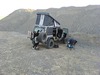
4×4 Road: Galena Canyon Road – Death Valley National Park


Photo credit The Greater Southwestern Exploration Company, CC BY 2.0. View at https://flic.kr/p/2oTqZE5
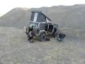
High clearance required 4×4 road up an alluvial fan to several old mining districts.
| Total Distance: 5.4 miles point to point (dead end) | Elevation Gain: 2,202ft. up, 2ft. down (-246ft. to 1,954ft.) |
| Road Difficulty: 2.3 | Bicycle Difficulty: More Difficult |
| View Rating: 3.0 out of 5.0 stars | Author’s Rating: 3.0 out of 5.0 stars |
| Visitor Rating: (Click to rate) [Total: 0 Average: 0] | Visitor Difficulty Rating: (Click to rate) [Total: 0 Average: 0] |
| Pets: Leashed (on the road) | Horses: Yes |
| Best Seasons: October-May | Special Permits: None |
| Water Availability: None | Overnight Options: Yes at least 1 mile from the West Side Road |
| Amenities: None | Crowd Factor: Solitude |
| Uses: | Road surface: |
| Features: | Hazards: |
Mile-by-Mile: Galena Canyon Road
0.0 Galena Canyon Road on the West Side Road (-246ft.). Turn up the rocky, pebbly road that ascends toward the Panamint Mountains. Use care, as the road may be washed out in places. As you drive, you’ll probably be able to see evidence of mining in the area – Pfizer, Inc. still owns and (sometimes) operates the mines along this road. The mines on the left (south) side of the road are the Bonny Mine, while the mines on the right (north) side are the Mongolian Mine. (36.031885°, -116.831105°)
4.5 Sideroad on left (south) to Bonny Mine (1,428ft.). The road to the two strip mines is very rough. Continue westward up the main road as it enters the hills around Galena Canyon. (36.020663°, -116.907983°)
4.6 Sideroad on left (south) to Bonny Mine 2 (1,506ft.). The road seems to lead up to an old mining area with much of interest. Continue on the main road. (36.019919°, -116.910465°)
4.8 Sideroad on left (south) to Mammoth Mine (1,599ft.). You can probably see the tanks up on the hill from this vantage point. The tanks held talc until it could be transported to market. Continue straight (west) on the main road. (36.019032°, -116.913266°)
4.9 Sideroad on right (north) to Mongolian Mine (1,642ft.). The first part of the road appears to be very washed out, so it may not be visible. Continue on the main road as it turns to the left (southward) up Galena Canyon. (36.018823°, -116.914697°)
5.0 Cabins on left (east) (1,743ft.). This is pretty much all that’s left of the town of the Kennedy Minerals Mining Camp. The cabins are slowly deteriorating, so use caution in the area. Continue up the main road. (36.017286°, -116.917624°)
5.1 Sideroad on left (south) and right (north). Both of these roads lead up to old mining areas. Continue straight on the main road. (36.0167585°, -116.9187345°)
5.4 End of Galena Canyon Road/White Eagle Claim (1,954ft.). Some interesting old mining structures can be found here. Retrace your route back down to the West Side Road. (36.013014°, -116.918899°)
History & More
One driver commented about the road that it was, “akin to driving across a beach covered inn [sic] a mix of small stones and boulders. It’s a rough ride and real puncture territory.”
The Bonny Mine is still in use, as of 2003, by the Minerals, Pigments, and Metals Division of Pfizer, Inc. (yes, the pharmaceutical company). You might see bulldozers at work. It has produced more than 30,000 tons of talc since 1970.
Remember that the mines are privately owned. So while no ban has gone out on seeing what’s there, you also are in a gray area as to exploration. Try to leave as little impact as possible.
The Mongolian Mine was first claimed in 1928, but little development was done until the 1970s. Pfizer still owns and operates the mines in the area.
The Mammoth Mine is relatively new by Death Valley Standards – it was prospected in the 1950s and only became claimed in 1963.
The Mammoth Mine was once used by Pfizer to extract talc to make talcum powder. Ore was mined out of an underground tunnel, brought to the surface in small ore cars, and dumped into the two large storage tanks until a truck could take it to market.
The White Eagle Claim (Death Valley Mine) was first worked in the late 1920s. The remote location and transportation issues plagued the mine, and it was not profitable. In 1938, eight men ran a grinding plant that produced 36 tons of talc per day. It’s hard to accurately estimate the total output of the mine, but it’s well more than 55,000 tons. Like the other mines in Galena Canyon, the mines are owned by Pfizer.
Talc is very soft and unstable. Most of the mines in the area have collapsed; do not enter any mines, whether they look strong or not.
Galena is a natural mineral form of lead(II) sulfide (PbS) – the most important ore of lead and also an excellent source of silver. It’s to be guessed that Galena Canyon is named after a lead vein – the nearby Queen of Sheba Mine had several silver-lead mines in its vicinity.
Download Road Map
Driving Directions
Along the West Side Road, 25.5 miles south of the northern terminus and 10.4 miles north of the southern terminus.
It is extremely dangerous to enter a mine due to unstable shafts, gasses, and more. Do not enter mines, even if they are apparently open!
Walking on, climbing, entering, ascending, descending, or traversing any mine, structure, feature, or ruin is prohibited.
Toxic chemicals or ore may be present around mine sites. Enter at your own risk.
Possessing, destroying, injuring, defacing, removing, digging, or disturbing any mine, structure, feature, or ruin is also prohibited.
Always be wary of flash floods in a canyon.
Camping in a canyon is discouraged due to the danger of flash floods.
Remember, it may be easier to climb up dryfalls than down them (or vice versa). Be sure you can climb in the other direction before climbing up or down a dryfall.
Camping is not allowed within one mile of a paved road, developed area, or dirt road that is closed to camping.
Camping is not permitted within 100 feet of a flowing stream, spring, or other natural body of open water.
No camping is permitted on the floor of Death Valley, within one mile of Darwin Falls and Greenwater Canyon, on the active/shifting sand dunes, and certain other canyons and backcountry areas.
Camping is also prohibited within one mile of the Ubehebe Lead Mine, Leadfield Mines, Keane Wonder Mill, and Skidoo Mill.
Camping is limited to 30 days per calendar year within the park.
Fires are permitted in NPS-provided fire grates or grills ONLY.
Leave No Trace Principles are enforced
Drones and model aircrafts are prohibited
Camping is permitted only in designated sites or in areas open to dispersed backcountry camping
All park rules and regulations
12 Month Pass: $55/Death Valley Annual Pass (valid at Death Valley National Park). $80/America the Beautiful Annual Pass (valid at all national park and federal fee areas). $20/Annual Senior Pass (62 years or older US citizens; valid at all national park and federal fee areas). Free/4th Grade Pass (Valid Sept. 1-August 31 of the child’s 4th Grade school year). Free/Military Pass (valid for all active military personel and their dependents with a CAC Card or DD Form 1173).
Lifetime Pass: $80/Lifetime Senior Pass (62 years or older US citizens; valid at all national park and federal fee areas). Free/Access Pass (available to all US citizens with perminent disabilities). Free/Access for Veterans and Gold Star Families Pass (valid for all military and veterans with a CAC card, Veteran HJealth Identification Card, Veteran ID Card, or veteran’s designation on state-issued drivers license or identification card.)