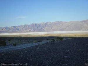
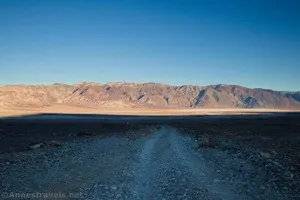
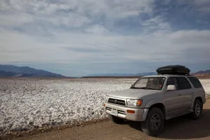
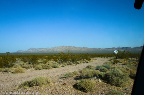
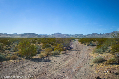
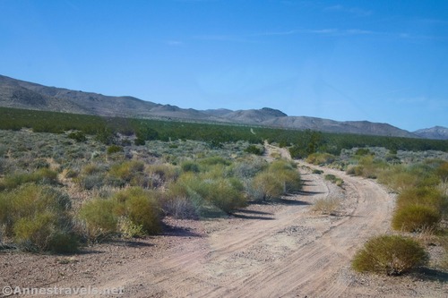
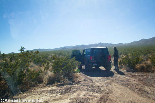
Greenwater Valley Road – Death Valley National Park

Follow a high-clearance-required dirt road between the Greenwater Range and the Black Mountains to access historic and beautiful sites. Total Distance: 28.3 miles point-to-point Elevation Gain: 897ft. up, 2,026ft. down (2,101ft. to 4,060ft.) Road Difficulty: 1.5 (high clearance recommended due to washboard) Bicycle Difficulty: More Difficult View Rating: Author’s Rating: Visitor Rating: Visitor Difficulty Rating: […]

Hole in the Wall Road – Death Valley National Park

Gravel/dirt road that gives access to Hole in the Wall and an old (mostly undeveloped) mining area. Total Distance: 6.0 miles point-to-point (dead end) Elevation Gain: 1,573ft. up, 5ft. down (992ft. to 2,562ft.) Road Difficulty: 1.2 for the first 3 miles; 2.0 beyond Bicycle Difficulty: More Difficult View Rating: Author’s Rating: Visitor Rating: Visitor Difficulty […]

Lee’s Camp Road – Death Valley National Park

Rough gravel/dirt road through mining country in the Funeral Mountains and past Lee’s Camp to a point near the “town” of Amargosa Valley. Total Distance: 18.2 miles point-to-point Elevation Gain: 1,658ft. up, 2,849ft. down (2,381ft. to 4,857ft.) Road Difficulty: 2.5+; 2.0 for southern 3 miles; 1.6 for northern 7.6 miles Bicycle Difficulty: Very Difficult View […]

Echo Canyon Road – Death Valley National Park

Gravel/dirt road that gives access to Eye of the Needle Arch and the Inyo Mine. Total Distance: 10.9 miles point to point Elevation Gain: 3,729ft. up, 27.5ft. down (410ft. to 4,120ft.) Road Difficulty: 1.4 for the first 3 miles; 2.0 beyond Bicycle Difficulty: Very Difficult View Rating: Author’s Rating: Visitor Rating: Visitor Difficulty Rating: Pets: […]

Keane Wonder Access Road – Death Valley National Park

The gravel road used to access the Keane Wonder Trailhead. Total Distance: 2.8 miles point to point (dead end) Elevation Gain: 665ft. up, 230ft. down (676ft. to 1,325ft.) Road Difficulty: 1.2 Bicycle Difficulty: More Difficult View Rating: Rating: Visitor Rating: Visitor Difficulty Rating: Pets: Yes Horses: No Best Seasons: October-May Special Permits: None. Gate closes […]

Racetrack Road – Death Valley National Park

A rough, unpaved, high-clearance-only road that leads to the famous lakebed with mysteriously moving rocks. Do not walk on the playa (mud) if it is wet. Total Distance: 29.5 miles point to point Elevation Gain: 2,693ft. up, 1,419ft. down (2,476ft. to 4,956ft.) Road Difficulty: 1.9 Bicycle Difficulty: More Difficult View Rating: Author’s Rating: Visitor Rating: […]

Titus Canyon Road – Death Valley National Park

Follow a gravel road to views, an old mining community, petroglyphs, and a slot canyon. Total Distance: 26.3 miles point to point (one-way road) Elevation Gain: 3,060ft. up, 6,302ft. down (5,261ft. to 175ft.) Road Difficulty: 1.5 Bicycle Difficulty: More Difficult View Rating: Author’s Rating: Visitor Rating: Visitor Difficulty Rating: Pets: Leashed Horses: Yes Best Seasons: […]

Monarch Canyon Road – Death Valley National Park

Rough dirt road down Upper Monarch Canyon to an old miner’s trail. Total Distance: 0.7 miles point to point (dead end) Elevation Gain: 12ft. up, 237ft. down (3,512ft. to 3,287ft.) Road Difficulty: 1.8 Bicycle Difficulty: More Difficult View Rating: Author’s Rating: Visitor Rating: Visitor Difficulty Rating: Pets: Leashed Horses: Yes Best Seasons: October-May Special Permits: […]

Chloride Cliffs Road – Death Valley National Park

Dirt road from US-95 to the Chloride City Road. Total Distance: 11.5 miles point-to-point Elevation Gain: 1,554ft. up, 119ft. down (2,913ft. to 4,405ft.) Road Difficulty: 2.0 Bicycle Difficulty: More Difficult View Rating: Rating: Visitor Rating: Visitor Difficulty Rating: Pets: Leashed Horses: Yes Best Seasons: October-May Special Permits: None Water Availability: None Overnight Options: Dispersed camping […]