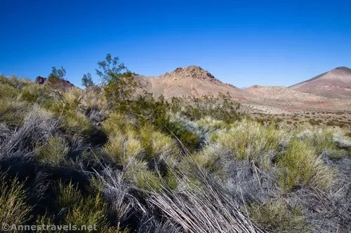
Daylight Spring – Death Valley National Park
Take an old road from Daylight Pass up to the brush around a spring in the desert.
| Total Distance: 0.6 miles out & back | Elevation Gain: 131ft. (4,321ft. to 4,436ft.) |
| Difficulty: Easy | 0-5 Mile Difficulty: Easy |
| View Rating: 2.0 out of 5.0 stars | Author’s Rating: 2.0 out of 5.0 stars |
| Visitor Rating: (Click to rate) [Total: 0 Average: 0] | Visitor Difficulty Rating: (Click to rate) [Total: 0 Average: 0] |
| Pets: No | Horses: Yes |
| Best Seasons: November-April | Special Permits: None |
| Water Availability: No potable water | Overnight Options: None |
| Trailhead Amenities: None | Crowd Factor: Solitude |
| Trailhead Access: 0.6 | |
| Uses: | Trail Surface: |
| Features: | Hazards: |
Mile-by-Mile: Daylight Spring
0.0 Parking area in Daylight Pass along the Daylight Pass Road (4,321ft.). Beginning by the sign with the elevation of Daylight Pass, head due west to find the old road to the spring. (36.788731°, -116.931967°)
300ft. Old Water Spigot (4,350ft.). Continue west to find the road. (36.788646°, -116.932861°)
0.1 Wire across the old road (4,375ft.). This is the remains of an old gate that kept vehicles away from the spring. Follow the old road westward. Pass a spring area about mile 0.25. (36.788670°, -116.933457°)
0.3 More or less end of the road (4,462ft.). The road ends here, and the brush around the spring is nearby. While there are views to a fair number of peaks both in the Grapevine and Funeral Mountains, most are unnamed or unofficially named. Views to the east (toward Beatty) are also excellent. (36.789132°, -116.936675°)
History & More
Springs like this one were a life source for settlers in the region. Towns and roads were often located strategically along routes to water sources.
Daylight Spring is on the Grapevine Mountains side of Daylight Pass. The peaks to the south (on the other side of the road) are in the Funeral Range.
The spring itself is hidden deep within the mass of brush and bushes. I didn’t try to bushwhack through the tangled mess.
Download Trail Map
Coming soon!
Driving Directions
Take the Daylight Pass Road (signed for Beatty) from Scotty’s Castle Road. At 6.7 miles, bear left to stay on the Daylight Pass Road. Keep climbing up to Daylight Pass, 6.2 miles later. The pass is also 13.1 miles southwest of Beatty, Nevada.
Leave No Trace Principles are enforced
Drones and model aircrafts are prohibited
Camping is permitted only in designated sites or in areas open to dispersed backcountry camping
Click here for all park rules and regulations
12 Month Pass: $55/Death Valley Annual Pass (valid at Death Valley National Park). $80/America the Beautiful Annual Pass (valid at all national park and federal fee areas). $20/Annual Senior Pass (62 years or older US citizens; valid at all national park and federal fee areas). Free/4th Grade Pass (Valid Sept. 1-August 31 of the child’s 4th Grade school year). Free/Military Pass (valid for all active military personel and their dependents with a CAC Card or DD Form 1173).
Lifetime Pass: $80/Lifetime Senior Pass (62 years or older US citizens; valid at all national park and federal fee areas). Free/Access Pass (available to all US citizens with perminent disabilities). Free/Access for Veterans and Gold Star Families Pass (valid for all military and veterans with a CAC card, Veteran HJealth Identification Card, Veteran ID Card, or veteran’s designation on state-issued drivers license or identification card.)


1 thought on “Daylight Spring – Death Valley National Park”