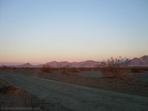
Dirt Road: Harry Wade Road – Death Valley National Park


Photo credit Micah Whiting, All Rights Reserved
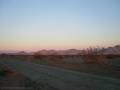
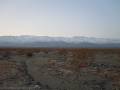
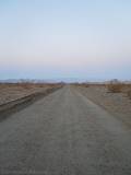
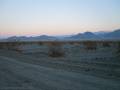
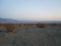
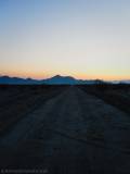
High-clearance road that gives access to the history of southern Death Valley. High clearance is required most of the year, but 4×4 is required or the road may be impassable when the Amargosa River is flowing.
| Total Distance: 25.75 miles point-to-point | Elevation Gain: 858ft. gain, 614ft. loss N to S |
| Road Difficulty: 1.5 (high clearance required) – 4×4 required or impassable when road is flooded | Bicycle Difficulty: Easy |
| View Rating: 3.0 out of 5.0 stars | Author’s Rating: 2.0 out of 5.0 stars |
| Visitor Rating: (Click to rate) [Total: 0 Average: 0] | Visitor Difficulty Rating: (Click to rate) [Total: 0 Average: 0] |
| Pets: Leashed | Horses: Yes |
| Best Seasons: October-May | Special Permits: None |
| Water Availability: No potable or reliable water | Overnight Options: Dispersed camping permitted except for the northernmost 1.0 miles of the road and the southernmost 1.5 miles (west of the Saratoga Springs Road – the southern side of the Harry Road in this area is not in Death Valley National Park). However, sites are almost non-existent. |
| Amenities: None | Crowd Factor: Solitude |
| Uses: | Road surface: |
| Features: | Hazards: |
Mile-by-Mile: Harry Wade Road
0.0 Harry Wade Road/Badwater Road/Jubilee Pass Road Junction (26ft.). Drive southeast on the Harry Wade Road. The road crosses multiple drainage channels, as well as the bed of the Amargosa River, so it may be impassable after heavy rains. (35.899862°, -116.656804°)
6.7 Old Road to Confidence Mill on right (west) (28ft.). Continue southeast on the Harry Wade Road. Views mostly stretch west to the remote and mysterious Owlshead Mountains. (35.842780°, -116.561001°)
12.4 Cross the Amargosa River (31ft.). The road has been crossing the riverbed for more than 2 miles before this, but the level of flow will determine how much of the bed is wet. The crossing will be impassible if it is too full (winter and spring) and is often dry in the autumn. If flow is low, 4×4 vehicles may be able to cross – always scout first! (35.7681772°, -116.5281717°)
19.2 Owl Hole Spring Road (151ft.). Some maps list this as the end of the Harry Wade Road; however, as the road continues without an official name down to the Saratoga Springs Road, I will include the remainder of the road to the Saratoga Springs Junction. (35.692766°, -116.490982°)
24.3 Road Junction on right (250ft.). Continue straight (left) on the main road. The road, which has been leaning eastward for some time, takes a decided turn to head almost due east. (35.651403°, -116.41642°)
25.75 Saratoga Springs Road Junction (270ft.). This is the end of the Harry Wade Road despite the fact that taking the main road straight brings you out to CA-127. The road beyond this point is known as the Saratoga Springs Road. (35.646732°, -116.391714°)
History & More
The Harry Wade Road is named for a man in the party of 49ers who traveled south to escape Death Valley in early 1850 – the group who gave the valley its name. Mr. Harry Wade discovered the path south that led out of the valley; the road that follows the old path was later named in his honor.
The Amargosa River is 185 miles long, flowing from the Amargosa Valley to Death Valley, where it vanishes into an underground aquifer. It rarely flows above ground in this section except after rain or snowmelt – when it can turn into a dangerous waterway. Chances are you’ll only see water from December-April, though it can flow at any time of year. The word “Amargosa” comes from a Spanish word meaning “bitter.”
Despite the fact that primitive camping is allowed at least 1 mile from the Badwater/Jubilee Pass roads, there is a definite lack of campsites or even places to park out of the way of traffic. However, it’s popular for brave/prepared backpackers to park their vehicles and head off into the canyons of the Owlshead Mountains to the west.
Download Road Map
Driving Directions
The north end of the road is at the junction where the Badwater Road and Jubilee Pass Road meet – 45.6 miles south of Badwater Junction and 25.0 miles west of CA-127 (via the Jubilee Pass Road). The south end of the Harry Wade Road is at the junction of the Saratoga Springs Road, 5.9 miles west of CA-127.
Camping in a canyon is discouraged due to the danger of flash floods.
Remember, it may be easier to climb up dryfalls than down them (or vice versa). Be sure you can climb in the other direction before climbing up or down a dryfall.
Camping is not allowed within one mile of a paved road, developed area, or dirt road that is closed to camping.
Camping is not permitted within 100 feet of a flowing stream, spring, or other natural body of open water.
No camping is permitted on the floor of Death Valley, within one mile of Darwin Falls and Greenwater Canyon, on the active/shifting sand dunes, and certain other canyons and backcountry areas.
Camping is also prohibited within one mile of the Ubehebe Lead Mine, Leadfield Mines, Keane Wonder Mill, and Skidoo Mill.
Camping is limited to 30 days per calendar year within the park.
Fires are permitted in NPS-provided fire grates or grills ONLY.
Leave No Trace Principles are enforced
Drones and model aircrafts are prohibited
Camping is permitted only in designated sites or in areas open to dispersed backcountry camping
All park rules and regulations
12 Month Pass: $55/Death Valley Annual Pass (valid at Death Valley National Park). $80/America the Beautiful Annual Pass (valid at all national park and federal fee areas). $20/Annual Senior Pass (62 years or older US citizens; valid at all national park and federal fee areas). Free/4th Grade Pass (Valid Sept. 1-August 31 of the child’s 4th Grade school year). Free/Military Pass (valid for all active military personel and their dependents with a CAC Card or DD Form 1173).
Lifetime Pass: $80/Lifetime Senior Pass (62 years or older US citizens; valid at all national park and federal fee areas). Free/Access Pass (available to all US citizens with perminent disabilities). Free/Access for Veterans and Gold Star Families Pass (valid for all military and veterans with a CAC card, Veteran HJealth Identification Card, Veteran ID Card, or veteran’s designation on state-issued drivers license or identification card.)