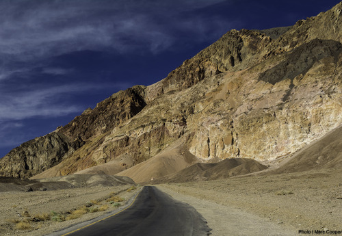
Gold Valley Road – Death Valley National Park

Follow a 4×4 track off of the Greenwater Valley Road through the Black Mountains to Willow Spring and Gold Valley. Total Distance: 13.0 miles point-to-point (dead end) Elevation Gain: 1,432ft. up, 1,877ft. down (4,479ft. to 2,637ft.) Road Difficulty: 2.0 (4×4 required) Bicycle Difficulty: More Difficult View Rating: Author’s Rating: Visitor Rating: Visitor Difficulty Rating: Pets: […]

Greenwater Townsite Road (South) – Death Valley National Park

This is the southerly of the two roads leaving the Greenwater Valley Road to approach Greenwater Townsite. From Greenwater, it continues northwest to meet the Furnace Townsite Road. Total Distance: 5.6 miles point-to-point Elevation Gain: 1,077ft. up, 192ft. down (3,880ft. to 4,765ft.) Road Difficulty: 1.8 (high clearance required) Bicycle Difficulty: More Difficult View Rating: Author’s […]

Furnace Townsite Road – Death Valley National Park

Take a high clearance dirt road off of the Greenwater Valley Road to the quiet site of a tent city. Total Distance: 4.0 miles point-to-point (dead end) Elevation Gain: 1,582ft. up, 4ft. down (3,480ft. to 5,057ft.) Road Difficulty: 1.8 (high clearance required) Bicycle Difficulty: Very Difficult View Rating: Author’s Rating: Visitor Rating: Visitor Difficulty Rating: […]

Greenwater Valley Road – Death Valley National Park

Follow a high-clearance-required dirt road between the Greenwater Range and the Black Mountains to access historic and beautiful sites. Total Distance: 28.3 miles point-to-point Elevation Gain: 897ft. up, 2,026ft. down (2,101ft. to 4,060ft.) Road Difficulty: 1.5 (high clearance recommended due to washboard) Bicycle Difficulty: More Difficult View Rating: Author’s Rating: Visitor Rating: Visitor Difficulty Rating: […]

CA-127 & NV-373 – Death Valley National Park

The state highway along the east side of Death Valley National Park, from Baker, CA (I-15) to US-95 north of Amargosa Valley, NV. Total Distance: 107.0 miles point to point Elevation Gain: 3,668ft. up, 1,939ft. down (406ft. to 2,663ft.) Road Difficulty: 0.6 Bicycle Difficulty: Easiest View Rating: Rating: Visitor Rating: Visitor Difficulty Rating: Pets: Leashed […]

CA-190: Furnace Creek to Stovepipe Wells

The main road through Death Valley between Furnace Creek and Stovepipe Wells. This guide begins where CA-190: Eastern border to Furnace Creek leaves off at Stovepipe Wells and connects to CA-190: Stovepipe Wells to Western Border. Total Distance: 24.2 miles point to point Elevation Gain: 1,049ft. up, 886ft. down (-249ft. to 150ft.) Road Difficulty: 0.6 […]

Echo Canyon Road – Death Valley National Park

Gravel/dirt road that gives access to Eye of the Needle Arch and the Inyo Mine. Total Distance: 10.9 miles point to point Elevation Gain: 3,729ft. up, 27.5ft. down (410ft. to 4,120ft.) Road Difficulty: 1.4 for the first 3 miles; 2.0 beyond Bicycle Difficulty: Very Difficult View Rating: Author’s Rating: Visitor Rating: Visitor Difficulty Rating: Pets: […]

Beatty Cutoff Road – Death Valley National Park

Cutoff road between CA-190 and the Daylight Pass Road. The southern end is at Beatty Junction and the northern end is at Hell’s Gate. Total Distance: 10.0 miles point to point Elevation Gain: 2,502ft. gain, 32ft. loss (-201ft. to 2,269ft.) Road Difficulty: 0.6 Bicycle Difficulty: Easy View Rating: Rating: Visitor Rating: Visitor Difficulty Rating: Pets: […]

Keane Wonder Access Road – Death Valley National Park

The gravel road used to access the Keane Wonder Trailhead. Total Distance: 2.8 miles point to point (dead end) Elevation Gain: 665ft. up, 230ft. down (676ft. to 1,325ft.) Road Difficulty: 1.2 Bicycle Difficulty: More Difficult View Rating: Rating: Visitor Rating: Visitor Difficulty Rating: Pets: Yes Horses: No Best Seasons: October-May Special Permits: None. Gate closes […]